


Mt Coudon + crêtes

cousam
User
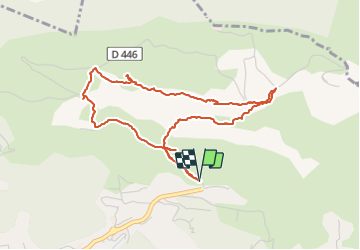

Length
4.9 km

Max alt
614 m

Uphill gradient
401 m
Km-Effort
10.3 km

Min alt
224 m

Downhill gradient
402 m
Boucle
Yes
Creation date :
2021-06-02 11:25:18.771
Updated on :
2021-06-02 16:13:29.388
2h32
Difficulty : Medium

FREE GPS app for hiking
 SityTrail
IGN / Geographical institutes
SityTrail Plus
The world is yours!
About
Trail Walking of 4.9 km to be discovered at Provence-Alpes-Côte d'Azur, Var, La Valette-du-Var. This trail is proposed by cousam.
Description
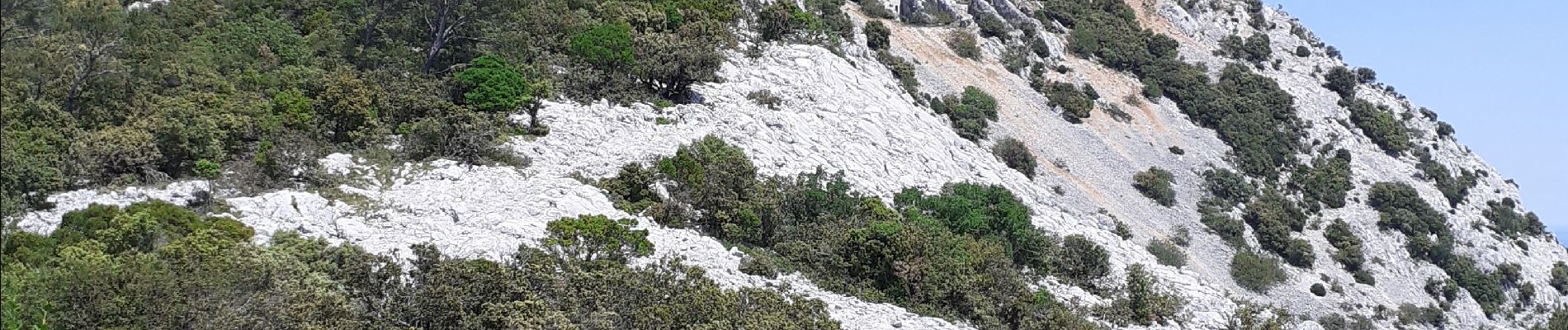
Montée assez hard pour arriver sur les crêtes, le retour est cool.
(Magalie et Rambo)
Photos


Positioning
Country:
France
Region :
Provence-Alpes-Côte d'Azur
Department/Province :
Var
Municipality :
La Valette-du-Var
Location:
Unknown
Start:(Dec)
Start:(UTM)
743561 ; 4782361 (31T) N.
Comments